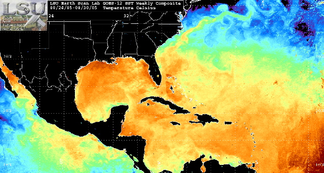
One of the reasons this storm was so destructive was because of the
warm water temperatures in the Gulf of Mexico, which serve as fuel to
hurricanes. At the time these measurements were taken, Katrina was just
to the east of southern Florida. You can see the warm area of water
circling around her on her southwest side. Once it crossed Florida, it
immediately received a lot of fuel, and then started heading southwest
towards another patch of warmer water. Once it made it through that, it
headed straight for southeast Louisiana, where the water was very warm.
In fact, the warmer water served as a magnet to draw Katrina straight
towards New Orleans.
Compare this map with that of last year's Ivan. Back
 Katrina's Water Temperature Map