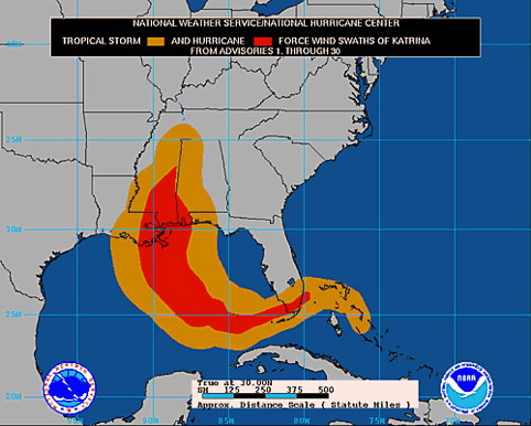
 Katrina's Wind Swath
This chart illustrates why Katrina was so destructive over such a wide
area. The red area below represents sustained winds over 74mph, with
higher gusts. The wind from the about 20 miles from the west wall of
the eye (near downtown New Orleans) to the bulge in the red area on the
right is where the most destruction occurred. Winds near the Superdome
were measured to be 145mph, so it is not inconceivable that winds on
the east side of the eye could have approached 200mph or more.
Buildings that survived Camille, with wind speeds up to 235mph, were
totally demolished by Katrina.